GIS in New Zealand
- GIS Shortcut

- Feb 15, 2021
- 13 min read
Updated: Feb 18, 2021

1. Introduction
Geographical information system (GIS) is a computerised mapping tool used to analyse and display of geographic information through maps and geographic data sets. Over the past century, it has developed in isolated countries such as New Zealand. Starting from the use of physical mapping, attempts were made by Abel Tasman (1642) as well as James Cook (1769) to a more accurate computerized mapping tool.
Throughout New Zealand’s history with GIS, it has successfully tackled many geographical problems and has opened up prospects which can be used up by planners. With such potential, GIS technology can sometimes come at a cost from the perspective of technology and the communities, contrasting with other informatics communities and their practices.
GIS is important in NZ as it is considered to be an important decision support tool that can improve decision performance and is useful for decision making (Lien, 2001). It can be a significant tool for the Maori communities, disaster management such as evacuation planning for volcanic hazards in New Zealand (Cole et al., 2005), ecotourism businesses (Dickey & Higham, 2005), sustainable aquaculture management (Longdill, & Black,2008), the conversation of threatened species that migrate to New Zealand such as the endangered seabird (Borrelle et al., 2015) and many other important uses, not only New Zealand but at a global scale.
This essay will discuss the current challenges and opportunities GIS brings in New Zealand (1) for the indigenous communities and (2) the education facilities.
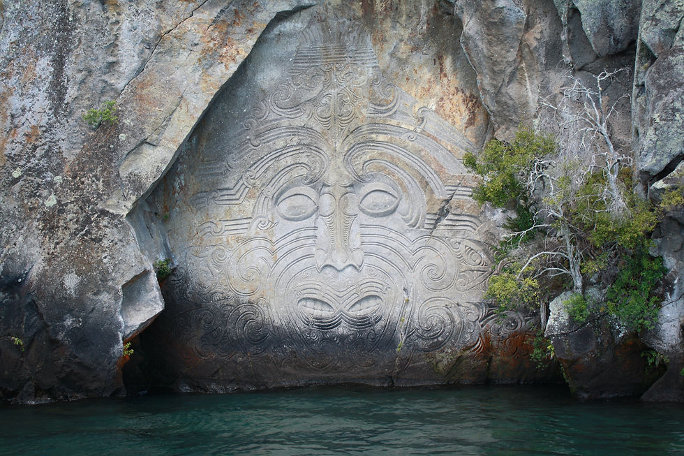
2. Culture: Māori Freshwater Values
In New Zealand, freshwater is a valuable resource and is at risk for over 15 years (Davies-Colley 2013, Parliamentary Commissioner for the Environment 2015). Fears regarding the water quantity and quality across New Zealand is currently being seen by the businesses, government, environmental managers and Māori communities (Office of the Minister for the Environment 2009, Land and Water Forum 2010).
Preserving freshwater is part of the mātauranga Māori (Māori knowledge systems) and Te Ao Māori (Māori world view) which mention a variety of values based on traditional knowledge and philosophy that generate many habitual roles and a discrete set of native culture, and spiritual values (Barlow 1993, Mead 2003, Awatere & Harmsworth 2014). The reduction in water quantity and quality across New Zealand, as well as its state of mauri (life energy, force), has been an important issue for Māori (Harmsworth et al. 2014). This reduction is generally shown in local tribal regions though extensive degradation of customary resources, such as low flows in streams and rivers, ecosystems, reduction in fauna and flora populations and the reduction of habitat areas (e.g., taonga species, mahinga kai).
Over time, this has caused Māori perspectives to change by somewhat conforming to Western scientific knowledge; a view consistent with numerous recent Māori authors stating that Māori knowledge as an evolving and dynamic concept which represents more than the past (Harmsworth 1997; Durie 1998; Harmsworth et al. 2002, 2011; Morgan 2003, 2006b, 2007). These values can be defined as instruments in a way that Māori can make sense of, interpret and experience their environment.
Māori could manage this is through tools such as GIS is being used in New Zealand since the mid-1990s. Maori inputs are important for the development of GIS in New Zealand, they make up about 15.4 % of the population in New Zealand (2016) (Stats NZ, 2020). GIS data is generally gathered in relation with hapū / iwi management plans to maintain the claims of the treaty which has become a vital tool many Māori organizations and tribes. The idea has been expanded by authors such as Harmsworth (1997) articulating that Maori communities are employing GIS tools to add their own cultural imprint to existing applications.
In this setting, Māori information is generally used to classify Māori principles, store, transfer knowledge and information record, identify the map and important sites. Spatial and temporal mapping and assessment, and native methods to using GIS are significantly documented (e.g., TRONT 2007; Robb et al. 2015) and can maintain aspects of collaborative freshwater management, such as scenario and modelling planning.
storing indigenous values of Maori culture of New Zealand in GIS. All the approaches adopted by these researchers for integrating GIS and IndigenousKnowledge for natural resource management has been participatory in nature involving local inhabitants. This approach is called Participatory GIS. Participatory GIS is widely used for community mapping or for participatory resource mapping with little variation in techniques and participatory tools used by different researchers Such examples of GIS being beneficial, includes its ability to: 1) empower Māori with claims negotiations and contemporary/post-settlement development opportunities (McDowall, 1999), 2) provide a medium for local government and Tangata whenua to interact (Kamau, 1999) and 3) use spatial information to make tribal land claims (Payne, 1991).
Similarly, Jackson (1997) used GIS within the Waitangi Tribunal Claim which caused the claims committee to employ GIS for its descriptive functionality. This created a series of maps that depicted useful information at hearings which enhanced the complex textual and oral evidence being presented. However, there are issues with some of the data, such as the NZ Archaeological Site database, which had errors in the initial recordings of sites along with out of date location grid references and inconsistent description of archaeological sites (Jackson, 1997, p. 101). These clusters of sites can be inaccurate. For example, the spatial dimensions of pā sites were not accurately recorded. As clusters of pā where marked on early geological maps which were not included on NZAA site records. The archaeological records did not always correspond with the traditional pā sites. As pā were not recorded while others were. Thus, it was found to be inaccessible (due to privately owned businesses on the land blocks).
2.1 Issues (data sovereignty)
The growth of these recently formed associations between the iwi/hapū and Crown (or delegated Crown agencies such as a regional council) normally do not have any issues/debates. These may emphasise the challenges of the power-sharing in a recently created meeting between government and Māori and the need for amended clearness of the local government practising the Treaty of Waitangi, and uncertainty about representation, membership, and rights of iwi/hapū are combined in the procedure. For instance, there are rare cases of actual complaining in New Zealand between iwi/hapū and councils (Awatere et al. 2012). Preferably, complaining should occur before co-management, but the rareness of arguments is possibly the bioproduct of the power of inequity between councils with legislative function, authority and Maori communities that have an insufficient amount of a specific participatory role, resources, and capacity. This creates more stress on the importance of contribution within the cooperative planning procedure.
Not only, is the use of GIS in indigenous communities prevalent in Maori groups, but can also occur in areas outside of New Zealand – At a global scale. For example, the Aborigine community in Australia use GIS for resource management (Gorman et al., 2008). Both issues can work with one another to furthermore develop GIS and change the limitations of GIS in terms of people’s perspectives, laws and frameworks.
2.2 Intellectual Property Rights
The sensitive and confidential nature of Māori knowledge (mātauranga Māori) needs to credit intellectual property rights which may in turn influence the way the data is recorded, stored (Harmsworth 1998). This needs to be added into all information use and sharing agreements especially when incorporating GIS technology. Systems should be created to limit, protect sensitive information from the general or public readership. An iwi data system can be used to save confidential information which can be determined by those whom the information originates from, such as Tangata whenua.
However, New Zealand does not have specific legislation to maintain bio-piracy (Royal Commission on Genetic Modification, 2001), but it has altered the Trademarks Act (1992) which protects improper registration of Māori symbols and words as trademarks domestically (Trademarks Act, 2002).
For Māori, the Indigenous Flora and Fauna Waitangi Tribunal Claim (WAI 262) and the Mataatua Declaration (1993), has also created discussion regarding the native intellectual property rights in New Zealand. To date, the Waitangi Tribunal has issued multiple reports and studies regarding mātaurang which clarify the problems that would traverse.
3. New Zealand: Pioneer Teachers and the Implementation of GIS in Schools

Unfortunately, in New Zealand, there is a lack of awareness of GIS even though over 60% of schools in New Zealand at some point integrated e-learning activities into their professional practices (Ministry of Education, 2006). A guesstimate, in 2003 indicates that from 32% and 18% of all composite and secondary schools had some exposure with GIS (Brodie, 2004, p.3). This is important as students who particularly enjoyed the open-ended laboratories are typically creative and develop research skills (Unwin, 1980). These kinds of open-ended exercises can be similar to teaching GIS at both a tertiary undergraduate (Read, 2010).
For GIS to grow, contribution needs to start a local scale within a single school and builds outwards to review classrooms nationally across New Zealand. For example, Diocesan School in Auckland provides full ArcView 3.2 (ArcView 3.2, 2006) and ESRI’s ArcVoyager (ArcVoyager, 2006) licenses to students which have caused almost all Year 8–10 from Social Studies and Year 11–13 Geography classes to use GIS at some point, in 2005.
A teaching unit which was helpful for year nine students was a unit called “Asian Tsunami,” by which students have learned historical tsunami patterns and the causes of a tsunami. Teacher’s integrated GIS within this unit by showing GIS maps and layers from projectors, causing students to gain knowledge of the global pattern of earthquakes in relation to high tsunamis risk zones.
There has been an interest in GIS in New Zealand schools since 1994. During which corporations such as Eagle Technology maintained GIS studies in schools which has led to the “Eagle Geography” project (Brown, 1994, as cited in Eddy & Olsen, 2012).
Over time, this has led to geography teachers, forming a company called GISMAPED (in 2004), which supports professional development for teachers through the use of spatial technologies. Since 2000, they have facilitated 45 secondary schools to purchase the software and created over 30 workshops throughout New Zealand (Olsen & Eddy, 2010, as cited in Eddy & Olsen, 2012).
3.1 Limitations
In 2004, a survey found that about 20% of New Zealand schools had GIS software (GISMAPED and Eagle Technology records, as cited in Eddy & Olsen, 2012). Since 2002, six or five schools on average have purchased the software annually with purchases decreasing over the past two years. These purchases consist of schools upgrading to ArcView 9 (Olsen & Eddy, 2010, as cited in Eddy & Olsen, 2012). The amount of pupils obtaining GIS credits has raised but percentages of geography pupils remain insignificant as the growth in the number of schools exposed to GIS has been at least 200% in the last 6 years (Brodie, 2004, p.8). Unfortunately, there are only a few topics that incorporate GIS, as there are less history and science teachers that have joined the GIS training workshops.
The interest in GIS has increased over time as members of the public can use GIS tools to complete Achievement Standards. However, it can be tough to estimate the number of schools which will incorporate courses with GIS achievement standards.
Additionally, technical problems can also reduce the number of schools using GIS from case study schools (shown above). This consist of insufficient network strength, teachers finding it challenging to maintain GIS information files, issues with school network managers mishandling the software and restricted computer access. A possible solution could be locally installing the GIS software though Web-based GIS portal which could eliminate some technical difficulties.

Another challenge to add to GIS in schools is the perspectives of GIS not being important; which is not necessary for the workplace or in tertiary studies of geography. Though it is correct that a degree in geography can be obtained without any GIS papers, it is false that GIS is not important in at a job. Teacher awareness and attitudes, along with an academically broad curriculum, means that GIS is not viewed as a tool which can analyse and alter spatial information. Few people within the workplace along with teachers lack in the knowledge of the career opportunities that GIS brings. Employees have specified to Eagle Technology that university graduates are less aware of GIS and need to be trained from the beginning (Thurlow, 2010, personal communication, GIS Training Manager, Eagle Technology, as cited in Eddy & Olsen, 2012).
It is important to incorporate GIS in schools as the geospatial industry, in 2008, can bring in $1.2 billion to the New Zealand GDP (ACIL Tasman, 2009). For the same year, ACIL Tasman estimates that a further $481 million loss due to a skills shortage of GIS which holds a tax revenue of $100 million.
The future of GIS in New Zealand secondary schools looks promising through the Achievement Standards in 2011. However, the growth of software specific to the needs of schools and easy access to lessons and information would aid the growth of GIS and make it simpler for more teachers to incorporate GIS into their teaching program.
4. Conclusion:
The use of GIS in New Zealand has influenced the way people think from the opportunities it brings such as supporting Maori values of freshwater and creating a new platform for teachers to grow and to teach a new significantly emerging skill to students. However, it can bring challenges such as the Maori sovereignty /intellectual property rights as well as introducing GIS to students on a larger scale around New Zealand.
Reference
ACIL Tasman (2009). Spatial information in the New Zealand economy: Realising productivity gains. Retrieved from http://www.geospatial.govt.nz/acil-tasman-report.
Awatere, S., and G. Harmsworth. (2014). Ngâ Aroturukitanga tika mô ngâ Kaitiaki: summary review of mātauranga Māori frameworks, approaches, and culturally appropriate monitoring tools for management of mahinga kai (Report no. LC1774). Hamilton, New Zealand: Landcare Research
Awatere, S., G. Harmsworth, S. Rolleston, and C. Pauling. (2012). Kaitiakitanga o ngâ ngahere pôhatu: Kaitiakitanga of urban settlements (pp. 236-259). Montreal, Canada: McGill-Queen’s University Press.
Barlow, C. (1993.) Tikanga Whakaaro: key concepts in Māori culture. Auckland, New Zealand: Oxford University Press
Borrelle, S. B., Buxton, R. T., Jones, H. P., & Towns, D. R. (2015). A GIS‐based decision‐making approach for prioritizing seabird management following predator eradication. Restoration Ecology, 23(5), 580-587. https://doi.org/10.1111/rec.12229
Brodie, S. (2004). GIS in years 7–13 social sciences education: A New Zealand perspective. Retrieved from https://proceedings.esri.com/library/userconf/educ04/papers/pap5097.pdf
Cole, J. W., Sabel, C. E., Blumenthal, E., Finnis, K., Dantas, A., Barnard, S., & Johnston, D. M. (2005). GIS-based emergency and evacuation planning for volcanic hazards in New Zealand. Bulletin of the New Zealand society for earthquake engineering, 38(3), 149-164. https://doi.org/10.5459/bnzsee.38.3.
Davies-Colley, R. J. (2013). River water quality in New Zealand: an introduction and overview. Lincoln, NZ: Manaaki Whenua Press. Retrieved from https://www.landcareresearch.co.nz /data/assets/pdf_file/0009/77058/2_12_Davie-Colley.pdf
Dickey, A., & Higham, J. E. (2005). A spatial analysis of commercial ecotourism businesses in New Zealand: A c 1999 benchmarking exercise using GIS. Tourism Geographies, 7(4), 373-388. https://doi.org/10.1080/14616680500291170
Douglas, E. M. K. (1984). Waiora, Wai Māori, Waitai, Waikino, Waimate: Māori perceptions of water and the environment (Occasional Paper No. 27). Hamilton, New Zealand: Centre for Māori Studies and Research, University of Waikato.
Durette, M. (2010). A comparative approach to Indigenous legal rights to freshwater: key lessons for Australia from the United States, Canada and New Zealand. Environmental and Planning Law Journal, 27(4), 296. Retrieved from http://sites.thomsonreuters.com.au/journals/files/2010/10/j06_v027_EPLJ_pt04_Durette1.pdf
Durie, M. (1998). Te Mana te Kawanatanga. Auckland, New Zealand: Oxford University Press.
Durie, M. (1998). Te Mana te Kawanatanga. Auckland, New Zealand: Oxford University Press.
Eddy, S. A., & Olsen, A. F. (2012). New Zealand: Pioneer teachers and the implementation of GIS in schools (pp. 179-189). https://doi.org/10.1007/978-94-007-2120-3_20
Gorman, J., Pearson, D., & Whitehead, P. (2008). Assisting Australian indigenous resource management and sustainable utilization of species through the use of GIS and environmental modeling techniques. Journal of Environmental Management, 86(1), 104-113. https://doi.org/10.1016/j.jenvman.2006.11.033
Harmsworth G. (1998). Indigenous values and GIS: a method and a framework. Indigenous knowledge and development monitor 6(3): 3-7. Retrieved from http://www.iapad.org/wp-content/uploads/2015/07/indigenous_values_and_GIS-a_method_and_a_framework.pdf
Harmsworth, G. (1997). Maori values for land use planning. New Zealand Association of Resource Management (NZARM) Broadsheet, 97, 37-52. Retrieved from http://www.landcareresearch.co.nz/research/social/indigenous_index.asp
Harmsworth, G. (1999). Indigenous values and GIS: A method and a framework. Business Alert, 14(1), 10-15. Retrieved from https://files.eric.ed.gov/fulltext/ED433982.pdf
Harmsworth, G. R. (2002). Coordinated monitoring of New Zealand wetlands, phase 2, goal 2: Māori environmental performance indicators for wetland condition and trend (Landcare Research Report LC 0102/099). Palmerston North, New Zealand: Landcare Research. Retrieved from http:// www.landcareresearch.co.nz/research/sustainablesoc/social/ Maori_indicators.asp
Harmsworth, G., Awatere, S., & Robb, M. (2016). Indigenous Māori values and perspectives to inform freshwater management in Aotearoa-New Zealand. Ecology and Society, 21(4). http://dx.doi.org/10.5751/ES-08804-210409
Jackson, M.A. (1997). Archaeology, GIS and Pouto Peninsula (Unpublished Masters thesis) (pp. 101). University of Auckland, Auckland, New Zealand.
Kamau, R. (1999). “Between Two Worlds”, The implementation of Geographic information Systems in Local Government with particular reference to the provision of resource management information to Iwi (Unpublished Masters thesis). University of Waikato, Hamilton, New Zealand.
King, M. (2003). The Penguin history of New Zealand. Wellington, New Zealand: Penguin Group (NZ).
Land and Water Forum. (2010). Report of the Land and Water Forum: a fresh start for fresh water. Wellington, New Zealand: Land and Water Forum
Lien, C. L. (2001). An Examination of the Decision Making Effectiveness of Geographic Information Systems (Unpublished Doctoral dissertation). University of Auckland, Auckland, New Zealand.
Longdill, P. C., Healy, T. R., & Black, K. P. (2008). An integrated GIS approach for sustainable aquaculture management area site selection. Ocean & Coastal Management, 51(8-9), 612-624. https://doi.org/10.1016/j.ocecoaman.2008.06.010
McDowall, C. (1999). Interpreting GIS As Mediator Between Intent And Practice. (Unpublished Masters thesis). University of Auckland, Auckland, New Zealand.
Mead, H. (2003). Tikanga Māori: living by Māori values. Wellington, New Zealand: Huia Publishers
Ministry of Education. (2006). ICT Professional Development Clusters – schools. Retrived from http://www.tki.org.nz.
National Institute of Water and Atmospheric Research (NIWA). (2010). Waikato River independent scoping study (NIWA Client Report: HAM2010-032). Hamilton, New Zealand: NIWA.
New Zealand Government. (2014). National Policy Statement for Freshwater Management 2014. Wellington, New Zealand: Ministry for the Environment. Retrieved from https://www.mfe.govt.nz/ publications/fresh-water/national-policy-statement-freshwater-management-2014
Office of the Minister for the Environment. (2009). New start for fresh water. Wellington, New Zealand: Minister for the Environment. Retrieved from http://www.mfe.govt.nz/more/cabinetpapers-and-related-material-search/cabinet-papers/freshwater/newstart-fresh-water
Parliamentary Commissioner for the Environment. (2015). Update report—water quality in New Zealand: land use and nutrient pollution (pp. 1-21). Wellington, New Zealand: Parliamentary Commissioner for the Environment. Retrieved from https://www.pce.parliament.nz/media/1008/update-report-water-quality-in-new-zealand-web.pdf
Payne, V.R.J. (1991). Urupare Torohiko – Planning for the Equitable Use of Spatial Information in the resolution of Treaty Claims (Unpublished Masters thesis) (pp. 81 - 100 ). University of Otago, Dunedin, New Zealand.
Read, J. M. (2010). Teaching introductory geographic information systems through problem-based learning and public scholarship. Journal of Geography in Higher Education, 34(3), 379-399. https://doi.org/10.1080/03098265.2010.490909
Robb, M., G. Harmsworth, and S. Awatere. (2015). Māori values and perspectives to inform collaborative processes and planning for freshwater management (Report no. LC2119). Lincoln, New Zealand: Landcare Research.
Royal Commission on Genetic Modification. (2001). Report from the Royal Commission on Genetic Modification (pp. 293). Wellington, New Zealand: New Zealand RoyaCommissionon on Genetic Modification.
Ruru, J. (2009). The legal voice of Māori in freshwater governance: a literature review. Lincoln, New Zealand : Landcare Research.
Sinner, J., and G. R. Harmsworth. (2015). Māori involvement in collaborative freshwater planning—insights from Hawke’s Bay. Policy brief. Freshwater Values, Monitoring and Outcomes (VMO) programme (MBIE contract no. C09X1003). Lincoln, New Zealand: Landcare Research
Stats NZ. (2020). Māori Population Estimates: Mean year ended 31 December 2016 – tables. Retrieved from http://archive.stats.govt.nz/browse_for_stats/population/estimates_and_ projections/MaoriPopulationEstimates_HOTPMYe31Dec16.aspx#gsc.tab=0
Te Rūnanga ô Ngāi Tahu (TRONT). (2007). Te Waipounamu freshwater report 2007: cultural health assessment of South Island waterways. Christchurch, New Zealand: TRONT.
Tipa & Associates. (2013). Cultural values, flow and water management issues for the Waikirikiri/Selwyn-Te Waihora catchments. Christchurch, New Zealand: Environment Canterbury Regional Council. Retrieved from http://files.ecan.govt. nz/public/lwrp/variation1/cultural-values-flow-water-managementissues-waikirikiri-selwyn-te-waihora-catchments.pdf
Unwin, D. (1980). Make your practicals open‐ended. Journal of Geography in Higher Education, 4(2), 39-42. https://doi.org/10.1080/03098268008708772
Waikato River Authority. (2011). Restoring and protecting the health and wellbeing of the Waikato River. Vision and strategy for the Waikato River. Hamilton, New Zealand: Waikato River Authority. Retrieved from http://www.waikatoriver.org.nz/wpcontent/uploads/2011/07/Vision-and-Strategy.pdf
Waitangi Tribunal. (2011). Ko Aotearoa Tenei: Te Taumata Tuatahi —a report into claims concerning New Zealand law and policy affecting Māori culture and identity. Wellington, New Zealand: Brooker & Friend.


Comments